Trail Walking Les Houches - Maison Neuve (Les Houches) boucle par Bellevue et Mont  Lachat - Photo

Maison Neuve (Les Houches) boucle par Bellevue et Mont Lachat

© OpenStreetMap contributors
Length
Length
13.6 km
Max alt
Max alt
2108 m
Uphill gradient
Uphill gradient
1013 m
Km-Effort
Km-Effort  
27 km
Min alt
Min alt
1149 m
Downhill gradient
Downhill gradient
1020 m
Boucle
Boucle
Yes
Creation date :
2023-06-08 08:00:44.554
Updated on :
2023-06-08 14:14:17.547

(0 Reviews)

Walking
Walking
4h00
Difficulty : Difficult

Scan this QR Code to open this trail in the SityTrail application

FREE GPS app for hiking

Logo SityTrail SityTrail

IGN / Geographical institutes

Download SityTrail from the App Store Download SityTrail from Google Play

Logo SityTrail SityTrail World

The world is yours!

Download SityTrail from the App Store Download SityTrail from Google Play Download SityTrail on Huawei AppGallery

About

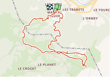
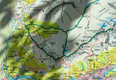
Trail Walking of 13.6 km to be discovered at Auvergne-Rhône-Alpes, Upper Savoy, Les Houches. This trail is proposed by ScarniereLaurent.

Description

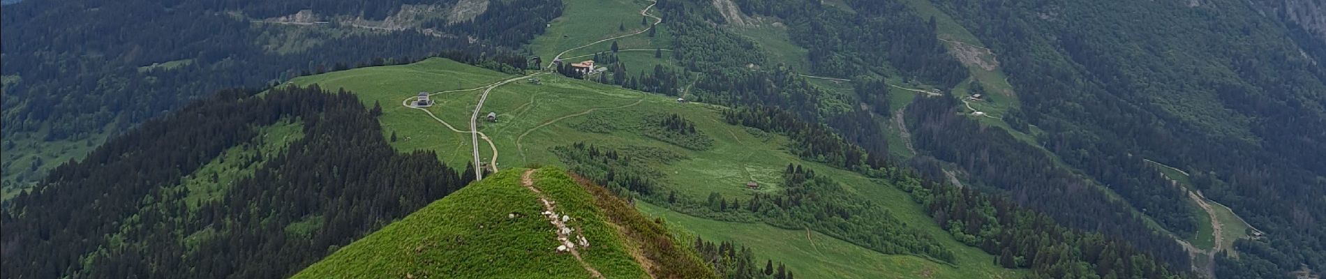
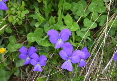
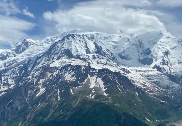
Très jolie boucle raide tant pour monter que descendre avec de superbes points de vue avec passages sous bois et parfois très dégagés.

Elevation profile

Photos

Positioning

Country:
France
Region :
Auvergne-Rhône-Alpes
Department/Province :
Upper Savoy
Municipality :
Les Houches
Location:
Unknown
Start:(UTM)
327537 ; 5084064 (32T) N.

Trails nearby

Trail Walking Chamonix-Mont-Blanc - Glacier des Bossons Les Houches Chamonix - Photo
Walking
tracegps

Walking

Difficult
(2)
Chamonix-Mont-Blanc, Auvergne-Rhône-Alpes, Upper Savoy, France
13.1 km | 28 km-effort
5h 0min
Yes
Trail Running Passy - grimpe de chedde ayeres - Photo
Running
winbat11

Running

Very easy
(1)
Passy, Auvergne-Rhône-Alpes, Upper Savoy, France
15 km | 28 km-effort
2h 46min
No
Trail Walking Les Houches - Chalets de Charlousse - Photo
Walking
YannPro81

Walking

Easy
(2)
Les Houches, Auvergne-Rhône-Alpes, Upper Savoy, France
9.2 km | 14.1 km-effort
2h 28min
Yes
Trail Walking Saint-Gervais-les-Bains - Descente au Glacier de Bionnassay depuis le Nid d''Aigle - Photo
Walking
GUIDE
pscheven

Walking

Very easy
(1)
Saint-Gervais-les-Bains, Auvergne-Rhône-Alpes, Upper Savoy, France
839 m | 1.9 km-effort
28min
No
Trail Walking Les Houches - boucle aiguillette des houches ,refuge bel-lachat - Photo
Walking
carton-fils@orange.fr

Walking

Very difficult
Les Houches, Auvergne-Rhône-Alpes, Upper Savoy, France
10.4 km | 24 km-effort
2h 49min
Yes
Trail Walking Les Houches - échec refuge de bellachat - Photo
Walking
carton-fils@orange.fr

Walking

Medium
Les Houches, Auvergne-Rhône-Alpes, Upper Savoy, France
3.9 km | 8.1 km-effort
2h 38min
Yes
Trail Walking Les Houches - Parc Animalier Merlet - Chalets de Chailloux - Aiguillettes des Houches - Photo
Walking
LtZIP

Walking

Difficult
Les Houches, Auvergne-Rhône-Alpes, Upper Savoy, France
11 km | 23 km-effort
5h 17min
Yes
Trail Walking Les Houches - Chamonix :  l'aiguillette des Houches - Photo
Walking
ETMU5496

Walking

Difficult
Les Houches, Auvergne-Rhône-Alpes, Upper Savoy, France
11.6 km | 25 km-effort
4h 4min
Yes
Trail Walking Saint-Gervais-les-Bains - LE PRARION  - Photo
Walking
joelinou

Walking

Very difficult
Saint-Gervais-les-Bains, Auvergne-Rhône-Alpes, Upper Savoy, France
12.3 km | 23 km-effort
5h 28min
Yes


Close
My subscriptions